When is the best time to visit Tasmania ?
It all depends on what you want from your holiday or short break. Summer holidays are easiest for many families needing to visit during the school holidays. Other people prefer the less crowded seasons of Autumn or Spring. For some, a cozy log fire in the depths of winter is the perfect winter escape.
Weather Seasons in Tasmania
|
Overview of the weather in Southern TasmaniaBeing and island, Tasmania's weather has less extremes than inland Australia. Most days have a temperature range of about 10 degrees. With direct exposure to the westerly winds from the ocean, we receive moderate rainfall spread over most of the year. Storms, downpours, long periods without rain, days over 30 degrees and nights below 2 degrees are all rare. Instead Tasmania's weather tends to be middle of the road but mostly about 5 degrees cooler than Melbourne or 8 degrees cooler than Perth, Sydney or Adelaide. |
How the weather works in Tasmania: A simple explanation with diagrams
Also shown below is general Tasmanian climate information, current warnings and seasonal overview.
In temperate zones, such as Tasmania, the weather is driven mostly by high pressure systems. Wind (shown by the arrows) blows anti-clockwise around these high pressure systems and they drift slowly eastwards. As the highs pass north of Tasmania, they bring alternating hot, cold, warm, hot air.
Each of the following steps takes one or two days to complete, sometimes longer. The cycle generally completes about every 4 to 8 days but can take longer. Generally the cycles are gentle, with most weeks having a pleasant mix of sun and cloud, rain and dry. We rarely have downpours and Hobart is the second driest capital city. However in an extreme one week period, Tasmania can occasionally experience a heatwave and bushfires, a thunderstorm, then snow, followed by a few days of calm.
There are many complicating factors (eg. low pressure systems have been neglected here) but this simple explanation gives an easy to follow, broad explanation.
|
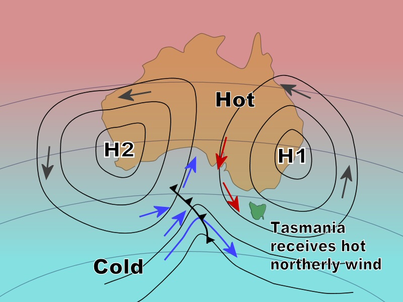
A high pressure system “H1” is centred near Sydney and H2 centred near Perth. The wind (shown by the arrows) blows anti-clockwise around each of these high pressure systems.
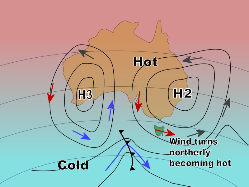
H1 brings hot dry air from Central Australia southward to Tasmania. Winds will generally be 10 – 30kmh, north to northwest, 25 – 30 degrees, dry, sky sunny. Possible bushfires. |
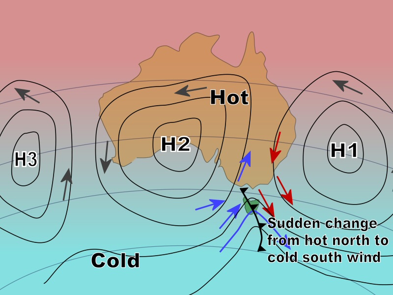
As H1 moves into the Tasman Sea, the hot northerly winds suddenly change to cold south westerly. This change is known as a “front” and is shown on the map as a line with triangles attached. Now Tasmania receives air driven by the next high pressure system “H2”. This air is cold, being brought to Tasmania from the Southern Ocean. Winds will suddenly increase to about 40kmh then generally ease to 20kmh, west to southwest, 10 – 15 degrees, wet, heavy cloud. Possible thunderstorms.
|
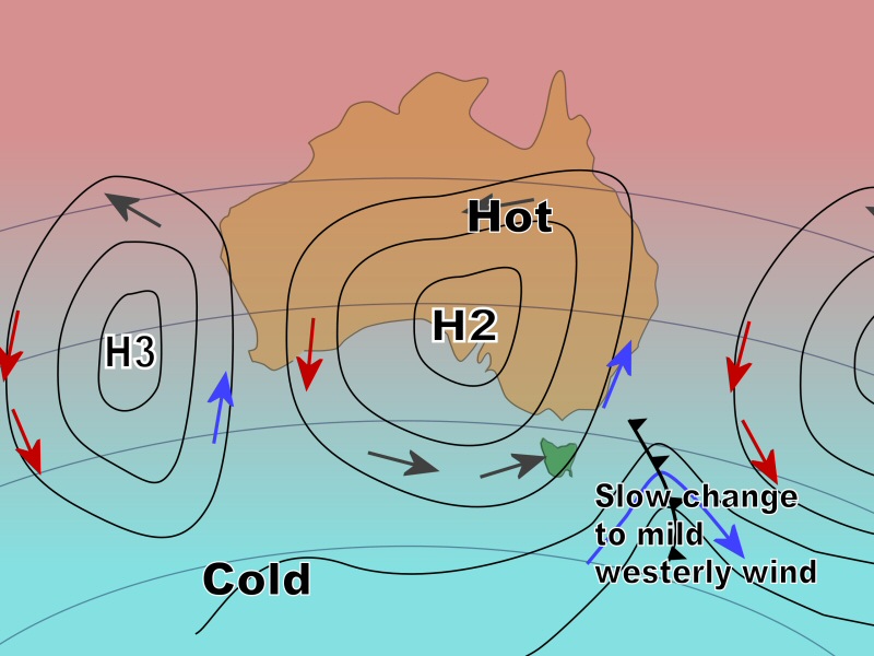
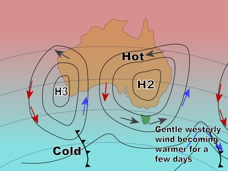
As H2 moves over Adelaide, it brings hot air from central Australia, over the ocean, and creates mild weather in Tasmania.
Winds will generally be 5 – 15kmh, west, 12 – 20 degrees, occasional light showers, sky partly cloudy. Possible snow. |
As H2 moves further east, it brings the hot air more directly from central Australia, over a short section of ocean, and creates warm weather in Tasmania.
Winds will generally be 5 – 15kmh, west to northwest, 18 – 25 degrees, very few light showers, sky mostly sunny. |
Now H2 is centred near Sydney. Again, this brings hot dry air from Central Australia to Tasmania.
Winds generally increasing from 10 to 30kmh, west changing to northwest, 20 – 30 degrees, dry and sunny. The cycle repeats as the next high “H3” approaches. |
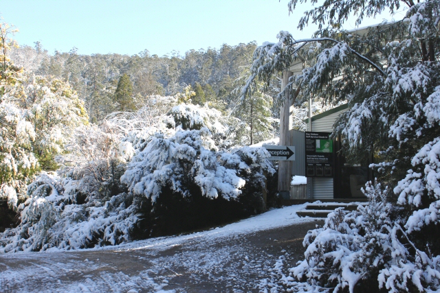
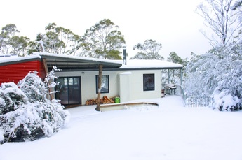
Tasmanian Record Snowfall Leaves Climate Skeptics ConfusedAt Huon Bush Retreats, 50 minutes south from Hobart, we experienced the deepest snow ever during August 2015. Our roads were closed for 2 days and 2 groups of guests were trapped. This has come just 18 months after our hottest day ever.
The Australian Bureau of Meteorology has confirmed what many Tasmanians already suspected, it has been the coldest winter in nearly 50 years. “...it's the sixth coolest on record, that's resulting in the coolest winter since 1966.” For more detail see http://www.abc.net.au/news/2015-08-31/tasmania-shivers-through-coldest-winter-in-50-years/6738326 How is it that a slightly warmer atmosphere can create weather that swings from one extreme to the next? From lazy jet streams to baking soils, in this report we explain the mechanisms behind some of the most catastrophic events of the decade? For the answers, see http://www.abc.net.au/catalyst/stories/3796205.htm Meanwhile, the Huon branch of the Liberal party has declared climate change is a furphy and green propaganda. At the September 2015 Liberal Party State Council in Hobart, the Huon branch said they want the Australian Government to focus on adapting to climate change "should it occur", rather than reducing carbon emissions.
See the full story at http://www.abc.net.au/news/2015-09-05/tasmanian-liberals-meet-to-thrash-out-state-issues/6752066
|
|
Home
|
Choose
|
Getting to Tasmania
|
Help
|
About Us
|
